Discover the Heart of Peace River

A Scenic Tour Through Some of Northern Alberta’s Hidden Gems

In the vast, rolling landscapes of northern Alberta’s Peace Country, where the Mighty Peace River carves through ancient valleys and history whispers from every hillside, an unforgettable adventure awaits. Leave the ordinary behind and embark on a tour that blends rugged natural beauty, living pioneer spirit, and panoramic vistas. Ride the Shaftesbury Ferry, wander Riverfront Park, meet the legendary Twelve Foot Davis, delve into the past at the Peace River Museum and Archives & Mackenzie Centre, then climb Judah Hill to the breathtaking Sagitawa Lookout. These interconnected stops in and around the Town of Peace River offer a perfect day of exploration that will leave you captivated by the region’s charm.

On August 14th, the MD Summer Bus tour will be heading to the Shaftesbury Ferry—one of only a handful of free-floating ferries still operating in Alberta. The bus will board this working ferry (part of Highway 740) for a short, roughly five-minute crossing of the wide Peace River. Operating roughly from mid-spring through mid-to-late fall, the ride delivers spectacular river-valley scenery and frequent wildlife sightings, from bears cooling off along the banks to soaring birds. It’s more than transportation; it’s a nostalgic, uniquely Albertan experience that connects the historic Shaftesbury Settlement flats—once home to early gardens and missions—with the far shore near Tangent Park.

Once back on solid ground, we will make our way to Riverfront Park in downtown Peace River. Nestled right along the waterway with easy trail access, this lively greenspace is the community’s gathering heart. Stroll the paths, relax in the gazebo, or simply watch the river flow past. It’s the ideal spot for a moment of riverside calm.

Standing proudly in the park is the iconic wooden statue of Twelve Foot Davis. Henry Fuller Davis, the larger-than-life (if short in stature) Vermont-born gold miner and free trader, earned his nickname in the 1860s Cariboo Gold Rush by staking a precise 12-foot claim between two larger ones—and striking it rich. He later became a beloved fur trader along the Peace River, competing with the Hudson’s Bay Company while winning friends with his hospitality and shrewd character. The Town of Peace River is sometimes called the “Land of Twelve Foot Davis” in his honour.

Deepen your connection to the region’s past at the Peace River Museum, Archives and Mackenzie Centre. Housed in a welcoming space overlooking the rivers, this museum brings the Peace Country’s story to life through engaging galleries. Explore the Sir Alexander Mackenzie Gallery, featuring artifacts from Fort Fork (where the explorer overwintered in 1792–93 before his historic journey to the Pacific), fur-trade relics including a period fur press and canoes, and exhibits on local Indigenous history, settlement, sternwheelers, and the growth of the town. Changing feature exhibits and a gift shop with local products round out the visit. Admission is by donation. It’s a perfect indoor complement to the outdoor adventures.

We’ll be capping the bus tour by ascending Judah Hill via Highway 744. This dramatic climb rises more than 200 metres from the valley floor, offering ever-changing perspectives of the landscape. At the top, step out at Sagitawa Lookout. The Cree name means “where the rivers meet,” and the view delivers exactly that: a spectacular panoramic sweep of the Town of Peace River and the dramatic confluence of the Peace and Smoky Rivers (with the Heart River nearby). Picnic tables, interpretive historical panels, and space for quiet reflection or photography make it an essential stop. Whether you’re capturing the layered valley walls, watching the rivers merge, or simply breathing in the vast northern air, Sagitawa rewards every visitor.

These locations form a natural loop through the Peace Country, allowing you to take in the region’s open skies, fertile river flats, and layered history of First Nations, explorers, traders, and settlers, creating an atmosphere of discovery that feels both timeless and welcoming.

Come ride the ferry across the Mighty Peace, stand in the shadow of Twelve Foot Davis, uncover stories at the Mackenzie Centre, and take in the world from Sagitawa Lookout. The Peace Country is calling—answer it, and you’ll leave with memories as wide as the northern horizon.


Call the MD office at (780) 864-3500 to save a spot on the bus!

Bus Fare: Age 16+ $25.00; Under 16 $5.00 

Fare is due upon registration. Riders are responsible for all expenses over and above the bus fare. 

Bus leaves the MD garage at 8:30 AM to pick up passengers at designated locations and will be returning between 3:30 PM and 4:00 PM. 

Priority given to seniors and people with limited mobility.

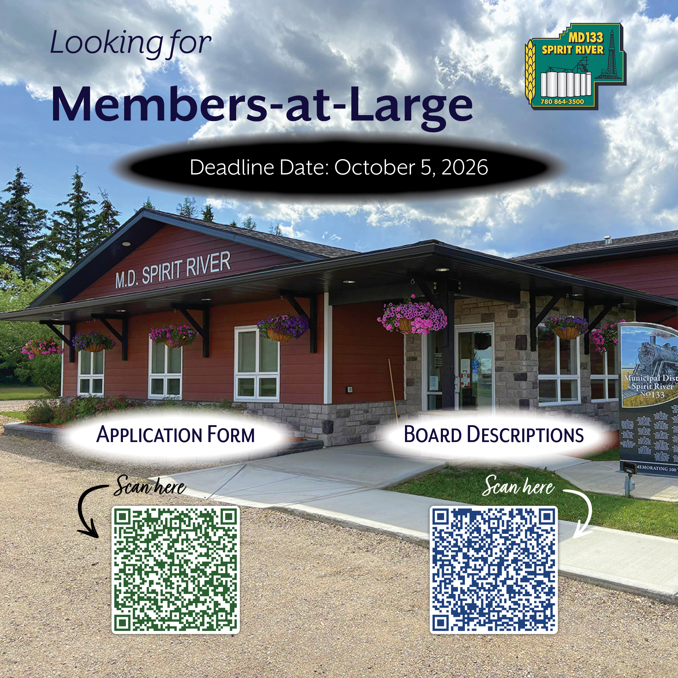
Members-at-Large Needed

With Council’s Annual Organization Meeting coming up in a few months, the MD of Spirit River #133 is accepting applications for the following boards & committees:

  • Agricultural Service Board
  • Agricultural Appeal Committee
  • Central Peace Assessment Review Board
  • Central Peace Family and Community Support Services Board
  • Peace Regional Subdivision and Development Appeal Board

If you are interested in being considered for one or more of the above boards, click Application Form or pop into the office @ 4202 – 50th Street for hard copies.

Application deadline is October 5, 2026.

Board & Committee Descriptions:

  • The Agricultural Services Board is tasked with promoting sustainable agriculture, managing weed and pest control, conserving soil and water resources, and assisting in the control of animal diseases. ASBs develop and implement local agricultural policies, advise municipal council, and work with the provincial government to enforce legislation related to agriculture.
  • The Agricultural Appeal Committee is a body established to hear and decide appeals against specific decisions made by agricultural authorities or agencies, and provide a formal process for individuals or organizations to challenge adverse decisions related to agricultural programs, regulations, or policies.
  • The Central Peace Assessment Review Board is an independent, quasi-judicial tribunal responsible for hearing appeals related to property assessments, classifications, and certain aspects of municipal taxation.
  • The Central Peace Family and Community Support Services (FCSS) Board is the governing body responsible for overseeing the delivery of preventive social services in the Municipal District of Spirit River #133, the Town of Spirit River, and the Village of Rycroft. It is responsible for determining how FCSS funding is allocated based on local needs and provincial prevention priorities within the FCSS mandate.
  • The Peace Regional Subdivision and Development Appeal Board is an independent, intermunicipal, quasi-judicial administrative board established under the Municipal Government Act and bylaws. It functions as a statutory body intended to perform an independent adjudicative function, similar to a court, by hearing and making decisions on appeals related to development permit decisions, stop orders, and subdivision decisions from participating municipalities.

To view the full document, go to Board & Committee Descriptions.

HWY 2 & TWP 780 Intersection Update

Construction Begins on Highway 2 & Township Road 780 Intersection Improvements

The Municipal District of Spirit River No. 133 is advising residents that construction has begun on the long-awaited Highway 2 and Township Road 780 intersection improvements. The project represents a significant investment in road safety and infrastructure and addresses the increasing volume of agricultural and industrial traffic travelling through this important corridor.

Earlier this year, the MD announced that Council had awarded the contract for the Highway 2 and Township Road 780 intersection upgrade following years of collaboration with Alberta Transportation. The need for improvements has grown alongside increased commercial activity in the area, particularly with the expansion of the G3 Grain Terminal and the continued movement of heavy agricultural equipment and grain-hauling traffic.

The project has been designed to improve safety for everyone who uses Highway 2 by adding dedicated turn lanes, improving sightlines, and strengthening the roadway to better accommodate heavy vehicles.

Construction Schedule

According to Alberta Transportation’s Notice of Highway and Bridge Construction Operations dated July 28, 2026, construction was scheduled to begin July 20, 2026, and is expected to continue until approximately August 22, 2026. Work will generally take place during daylight hours between 7:00 a.m. and 7:00 p.m., five to six days per week, weather permitting.

Construction activities will occur on Highway 2 between km 3.409 and km 4.063, and between km 10.878 and km 11.810, encompassing improvements at the Township Road 780 intersection as well as additional highway work.

What Motorists Can Expect

Throughout construction, motorists should anticipate:

  • Reduced speed limits through the construction zone
  • Lane closures and one-lane traffic where required
  • Flag persons directing traffic
  • Rough or uneven pavement during various stages of construction
  • Delays of up to 30 minutes
  • Increased construction equipment and workers on site

An Order Fixing Maximum Speed Limit has also been issued under Alberta’s Traffic Safety Act. Drivers are reminded that temporary speed limits will be posted throughout the construction zone and must be obeyed whenever signs are in place.

A Message to Farmers and Heavy Haul Operators

With construction taking place during the busy growing season, the MD recognizes that many producers will be moving equipment between fields while commercial carriers continue transporting grain and other commodities.

Farmers, custom operators, trucking companies, and all motorists are encouraged to allow extra travel time, remain alert for changing traffic patterns, and exercise additional caution when travelling through the work zone. Patience and reduced speeds will help protect construction crews as well as everyone sharing the roadway.

Stay Informed

As the project progresses, the MD of Spirit River No. 133 will share any updates regarding traffic impacts and construction progress through its:

  • Website
  • Facebook page
  • Voyent Alert notifications

Motorists can also check 511 Alberta for current highway conditions and travel advisories.

The Alberta Transportation construction notices and location map are available at the links below for anyone wishing to review the project in greater detail.

Notification of Highway & Bridge Construction Operations

HWY 2 & TWP 780 Location Map

HWY 2 Order Fixing Maximum Speed Limit

REMINDER! Bursary Deadline is This Friday

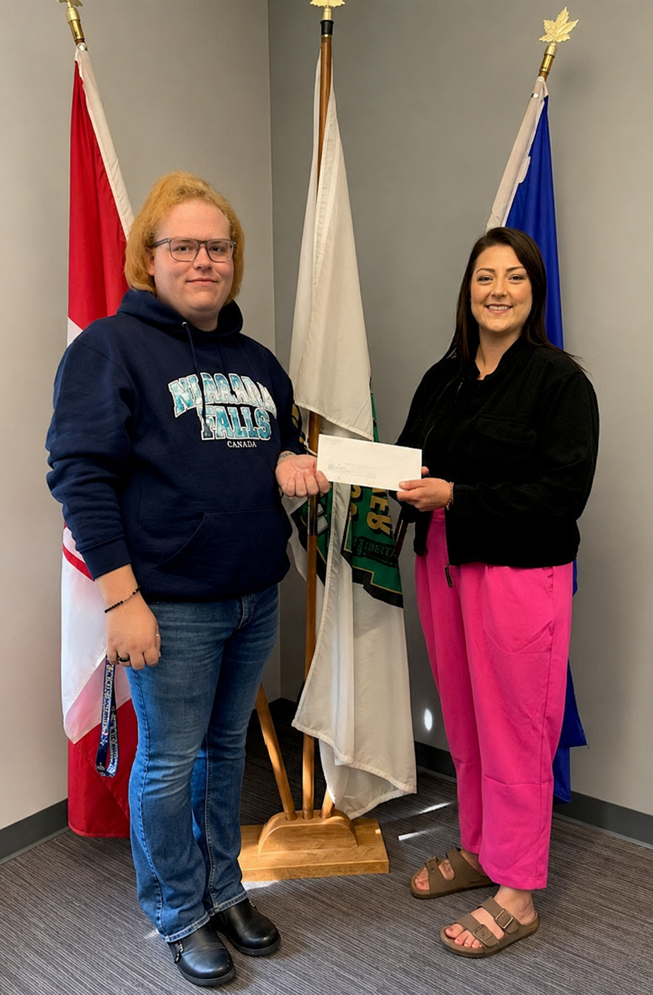
If you’re a resident of the MD of Spirit River #133 and are pursuing 𝗳𝘂𝗹𝗹-𝘁𝗶𝗺𝗲 𝗽𝗼𝘀𝘁-𝘀𝗲𝗰𝗼𝗻𝗱𝗮𝗿𝘆 𝗲𝗱𝘂𝗰𝗮𝘁𝗶𝗼𝗻, don’t miss your opportunity to apply for a $𝟭,𝟬𝟬𝟬 𝗠𝗗 𝗕𝘂𝗿𝘀𝗮𝗿𝘆.

This bursary recognizes students who demonstrate leadership, community involvement, and a commitment to making a positive difference. Whether you’re beginning your post-secondary journey or continuing your studies, we encourage you to apply.

Applications are available online at mdspiritriver.ab.ca/departments/administration/bursaries/ or can be picked up at the MD Office, 4202–50 Street, Spirit River.

𝗔𝗽𝗽𝗹𝗶𝗰𝗮𝘁𝗶𝗼𝗻 𝗗𝗲𝗮𝗱𝗹𝗶𝗻𝗲: 𝗝𝘂𝗹𝘆 𝟯𝟭, 𝟮𝟬𝟮𝟲

Your education is an investment in the future—and your community is proud to invest in you.

From End of Steel to Mile Zero

Dawson Creek’s Living Heritage

The next stop on our Summer Bus Tour is Friday, August 7, 2026, when we will be heading for Dawson Creek.

Dawson Creek, British Columbia—known as the “Mile 0 City” at the southern terminus of the Alaska Highway—preserves its agricultural, railway, and pioneer heritage through three closely linked sites: the Dawson Creek Art Gallery, the N.A.R. Station Museum, and Walter Wright Pioneer Village. These attractions, shaped by local societies, volunteers, and civic effort, transform everyday structures of the South Peace into living records of settlement, grain shipping, rail arrival, and wartime transformation.

The N.A.R. Station Museum and N.A.R. Park

The Northern Alberta Railway (N.A.R.) Station stands as the only designated heritage building in Dawson Creek and anchors N.A.R. Park at the top of 10th Street on Alaska Avenue. In January 1930, the N.A.R. bought land from Duncan McKellar for its yards and reservoir; surveyor Olav Aaberg laid out the first twelve blocks of the new town site, which went on the market that September. The older settlement of Dawson Creek relocated roughly two miles to meet the rails. The final spike was driven on December 29, 1930; the first passenger trains arrived on January 15, 1931, before the station itself was completed in June of that year.

The station served as the western terminus—end of steel—and later as the logistical starting point for Alaska Highway construction in 1942, when troops, supplies, and equipment poured through the yards. Passenger service ended in 1974; the last steam locomotive had already departed in 1960. In 1977, the South Peace Historical Society, under president Walter Wright, purchased the station from the N.A.R. for one dollar. The City of Dawson Creek later acquired the surrounding 4-acre parcel (after negotiations that settled at $315,000) and developed it into N.A.R. Park with lottery grants, municipal funds, interest earnings, and a $250,000 TIDSA tourism grant. Restoration work, aided by Katimavik volunteers and a B.C. Heritage Trust grant, prepared the building for public use.

N.A.R. Park and the Dawson Creek Station Museum officially opened on June 17, 1983. The museum recreates the station agent’s living quarters upstairs and presents four additional galleries covering pioneer settlement, the railway era, wildlife and natural history, and Alaska Highway construction. It shares space and hours with the Tourism Dawson Creek Visitor Information Centre. In 1984, the Canadian Heritage Foundation awarded the park, station, and grain elevator a National Award of Honour.

Dawson Creek Art Gallery

The Art Gallery occupies a renovated 1949 Alberta Wheat Pool grain elevator annex in the same park—an architectural and historical landmark of the region’s agricultural boom. Northeastern British Columbia opened to farming in the 1920s and 1930s; by the mid 1940s the Dawson Creek area ranked among the British Empire’s most productive grain districts for its size, supporting thirteen wooden elevators. Larger concrete elevators later rendered the wooden structures obsolete.

In 1982, with only two elevators left, a “Save the Elevator Committee” (including artist Edna McPhail) persuaded the City to act. The Alberta Wheat Pool sold a 65,000-bushel elevator, 45,000-bushel annex, scale house, and office for one dollar on the condition that everything be moved by November 30th. Mix Brothers of Edmonton relocated the structures (the annex alone weighed 290,000 lbs.; the elevator 460,000 lbs.) to N.A.R. Park between November 19 & 26, 1982 at a cost of roughly $110,000, later supported by provincial, federal, and foundation grants. Local architect Jim Rose designed a spiraling ramp system that created about 200 linear feet of exhibition space inside the annex while preserving the elevator’s exterior and adding interpretive panels on grain-elevator operations.

The South Peace Art Society (roots in a 1940s/1950s art group, registered 1962) opened the gallery on October 23, 1983 (some accounts note October 21st). It was the first public art gallery in northern British Columbia. In 1984, it received a Heritage of Canada Foundation Award of Merit; in 2014, the Architecture Foundation of British Columbia named it the northern winner of its Best Building contest. Operated by the artist-run South Peace Art Society on behalf of the City, the gallery presents local, regional, and touring exhibitions year-round, maintains a permanent collection, and houses the Grainery Artisan and Gift Shop. The original main elevator remains open for self-guided tours in summer.

Walter Wright Pioneer Village

Walter Wright (1915–1980), a long-time Dawson Creek resident, businessman, alderman, and president of the South Peace Historical Society, drove the creation of a pioneer village to preserve buildings and artifacts from the 1912–1945 era. The South Peace Historical Society, governments, service clubs, and volunteers assembled original structures moved from the surrounding countryside plus carefully rebuilt replicas, staging them along a gravel main street with boardwalks. Artifacts, vintage vehicles, and farm machinery completed the scene. The village first opened near the airport on Highway 2 around 1970 (sometimes listed as 1969 or opened to the public later in the decade) and was renamed in Wright’s honour in 1981.

In June 1992, as part of the Rendezvous ’92 celebrations marking the 50th anniversary of the Alaska Highway, the village was relocated and reopened adjacent to Rotary Lake (now part of Mile 0 Park) at 1901 Alaska Highway. The South Peace Mile 0 Park Society was formed that year to manage the village, campground, and lake facilities; the Historical Society retains ownership of the historic buildings and leases them for operation. Notable structures include the 1916 Dawson Creek School (originally Pouce Coupe School), the 1918 Pouce Coupe School, the 1920 St. Paul’s Anglican Church, the 1928 W.O. Harper General Store (replica), the Taylor House (1928), a trapper’s cabin, blacksmith shop, fire hall replica housing historic trucks, Sudeten Hall (built by Sudeten German immigrants who arrived in 1939), and later additions such as a multiplex of period offices and shops. Gardens North and a memorial rose garden enhance the site. Admission is by donation.

Shared Legacy

These three sites form a connected heritage landscape. The South Peace Historical Society (founded 1952) created and continues to support the Station Museum and Pioneer Village; the South Peace Art Society operates the gallery. Together they illustrate how Dawson Creek grew from a railway terminus and grain-shipping centre into the logistical base for the Alaska Highway, while successive generations of residents rescued the physical evidence of that story—grain elevators, a railway station, and pioneer buildings—and gave them new public purpose. Today they welcome travellers, school groups, and locals, keeping the South Peace’s agricultural, transportation, and settlement history tangible and accessible.


Call the office at 780-864-3500 to save a spot on the bus!

Bus Fare: Age 16+ $25.00; Under 16 $5.00

Fare is due upon registration. Riders are responsible for all expenses over and above the bus fare. 

The Bus leaves the MD garage at 8:30 AM to pick up passengers at designated locations and will return between 3:30 PM and 4:00 PM.

* Priority given to seniors and people with limited mobility. *


Telephones Lines are Down

We are currently experiencing technical difficulties with our phone lines; however, we are still able to receive messages. You may either leave a voicemail at (780) 864-3500 or email us at mdsr133@mdspiritriver.ca.

Thank you for your cooperation as we work to resolve this issue.

Office Closed July 23rd for Public Event

Don’t Miss It—Tomorrow!

The MD of Spirit River’s Annual Ratepayers’ BBQ & Seniors Appreciation Day is happening tomorrow, Thursday, July 23, from 11:00 a.m. to 2:00 p.m. at Nardam Campground!

Join us for a delicious BBQ, entertainment, prize draws, and the opportunity to meet your Council, municipal staff, and local organizations. Whether you’re coming to connect with neighbours, learn about community resources, or simply enjoy a great afternoon, we’d love to see you there!

Bring your lawn chair, bring your appetite, and join the fun!

Girouxville: A Hub of Pioneer History, Faith, and Pilgrimage

Next stop on our 2026 Summer Bus Tour is on July 24th where we will be heading to Girouxville to visit their museum, the Catholic Pilgrimage site, and the Stations of the Cross at Notre Dame de Lourdes.

Nestled in the Smoky River Region of northern Alberta, the small francophone village of Girouxville (population around 278) preserves a rich tapestry of pioneer life, missionary heritage, and Catholic devotion. At its heart stand two closely linked attractions: the Girouxville Museum and the adjacent Catholic pilgrimage site centered on the Notre Dame de Lourdes Church and Grotto. Together with outdoor Stations of the Cross, these sites offer visitors a poignant glimpse into the French-Canadian settler experience and enduring spiritual traditions in the Peace Country.

The Girouxville Museum: Preserving Pioneer and Missionary Legacy

The Musée Girouxville Museum, located at 5015-50th Street on the village’s main street, opened its doors in 1969. It was the vision and dedicated work of Father Clément Desrochers, O.M.I. (1910–2003), an Oblate missionary, historian, and community pillar who recognized the rapid loss of artifacts from the region’s early settlement days.

The museum houses over 6,000 artifacts illustrating the history of pioneers and missionaries who settled the Smoky River area. Exhibits span natural history, transportation (including an Autobaggan from the Northwest Territories and antique vehicles like a 1954 fire truck and a Studebaker Commander), communications, education, photography, the fur trade, hunting, trapping, and daily rural life. Unique items, such as a five-legged squirrel, captivate visitors of all ages. An additional “Auto Building” on the premises displays more machinery and vehicles.

The collection reflects the broader context of Girouxville’s history. Originally known as Fowler (a railway station name), the community was renamed in 1915 after an early settler named Giroux. The first post office opened in 1917. French-speaking settlers, many from Quebec guided by Oblate missionaries, arrived in the early 20th century to farm the fertile lands. The Cree referred to the area as “umstosee owuskee” (“Frenchman’s Land”). Girouxville became a village in 1951, with institutions like a credit union (1941) and co-op underscoring its cooperative, culturally vibrant character.

Today, the museum—managed by the village and volunteers—operates seasonally (typically late June to mid-August) and by appointment off-season. It serves as a vital cultural anchor, complemented by the village’s French heritage.

The Catholic Pilgrimage Site: Notre Dame de Lourdes Church and Grotto

Next door to the museum stands the Paroisse Notre Dame de Lourdes (Our Lady of Lourdes Parish) and its neighboring grotto, a focal point for Catholic devotion in the Archdiocese of Grouard-McLennan. Father Clément Desrochers also played a key role here, instituting the annual pilgrimage in 1950—making it a tradition spanning more than seven decades.

The site replicates elements of the renowned Sanctuary of Our Lady of Lourdes in France, honoring the 1858 apparitions to St. Bernadette. The Girouxville grotto, located in the village center near the church at 4904 50 Ave, features statuary, paintings, reliquaries, and sacred artifacts. Many of these items are also represented or housed in the adjacent museum. The pilgrimage draws faithful from across the archdiocese, especially around the Feast of the Assumption (August 15).

Typical events include Masses (often bilingual), rosary, reconciliation, vespers, processions (including candlelight and with the Blessed Virgin Mary statue), benediction, a healing service, and communal meals. The 2022 schedule, for example, featured a vigil Mass, movie screening, and Divine Mercy Chaplet, blending prayer, reflection, and fellowship.

The site embodies the deep faith of the French-Canadian pioneers and missionaries who built the community amid the challenges of northern settlement.

The Outdoor Stations of the Cross at Notre Dame de Lourdes

Complementing the church and grotto are the outdoor Stations of the Cross (Chemin de Croix), providing a contemplative path for pilgrims to meditate on Christ’s Passion. These stations form part of the sacred grounds, enhancing the pilgrimage experience with an immersive, open-air devotional walk amid the natural surroundings—typical of many Catholic shrines that feature a Calvary or outdoor Via Crucis.

While specific construction details for Girouxville’s stations are tied to the broader development of the grotto site under Father Desrochers’ influence, they align with the 14 traditional stations and support processions and personal prayer. Visitors and locals can walk them as part of regular devotions or during the annual pilgrimage, fostering a tangible connection to faith in a serene rural setting.

A Living Heritage

Girouxville’s museum and pilgrimage site are more than tourist stops; they are testaments to resilience, cultural preservation, and spiritual life in Alberta’s Peace Country. Father Desrochers’ dual legacy—safeguarding material history while nurturing faith—continues to draw visitors and pilgrims. Whether exploring pioneer artifacts by day or joining evening processions at the grotto, one encounters the intertwined stories of those who shaped this Francophone corner of the prairies.

For current hours, events, or visits, check the Village of Girouxville website or contact the museum directly @ 780-323-4252. In a world of rapid change, these sites quietly invite reflection on roots, community, and enduring belief.

Click 2026 Summer Bus Tour to view the remaining tours for this year.